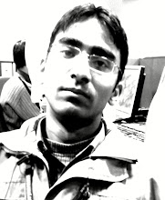
VIKASH SHARMA
------------------------
Ranikhet, Distt : Almora
Uttarakhand
Ph: +91 9997257507
E.mail : plurkt@gmail.com, plurkt@yahoo.co.in
------------------------
Ranikhet, Distt : Almora
Uttarakhand
Ph: +91 9997257507
E.mail : plurkt@gmail.com, plurkt@yahoo.co.in
CARRIER OBJECTIVE:
Utilization and development of my knowledge and attitude to achieve excellence in the field of geography, GIS and Remote Sensing and gain knowledge by experience to achieve my best.
EDUCATIONAL QUALIFICATION:
PG Diploma in Remote Sensing and GIS:
2007, 73% marks, Center for Advanced study in geology, University of Lucknow.
Post Graduation:
2006, Geography, 66.8 % marks, Department Of Geography, University of Lucknow.
Graduation:
2004, Geography, Political Science & Economics. Govt. P.G. College, Kumaun University, Nainital.
Intermediate:
2000, Hindi, English, Physics, Chemistry & Biology, National Inter Collage, Ranikhet, Uttarakhand.
High school:
1998, Hindi, English, Maths-2, Science-2, social sciences & Biology. National Inter Collage, Ranikhet, Uttarakhand.
ADDITIONAL QUALIFICATION:
Diploma in Computer Programming: 2001, (GW Basic, C, C++, JAVA), A Grade, CDAC.
ACADEMIC PROJECTS:
Project presented in Directorate of geology and mining, U.P. on the topic “Geomorphological mapping of Girar area, District Lalitpur, U.P.” with the help of Remote Sensing and GIS.
WORKSHOPS:
Participated in one week workshop on surveying at Geological Survey of India, organized in December 2006.
SEMINARS PRESENTED :
1). Paper presented on the topic ‘Historical aspects of Geography’ on 15 Nov 2005, Deptt. Of Geography, University of Lucknow, Lucknow.
2). Attended National Conference on “Contemporary Issues in Regional Development”, Department Of Geography, march 2006, University Of Lucknow, Lucknow.
Attended National Seminar on Remote Sensing at the Centre for Advance study in Geology, University of Lucknow, organized between 10th and 11th march,2007.
EXPERIANCE:
Currently working in State Water Resources Agency, Lucknow, UP as a GIS Analyst and preparing detailed Irrigation data for the state of U.P.
Worked for more than 1 year in RMSI Pvt. Ltd. Dehradun, as a Assistant GIS Engineer and worked in various projects :
Federal Emergency Management Agency, USA : Flood mapping of USA.
Role : I worked as a production person in this project and my work was appreciated by my seniors.
Geological survey of japan : Digitization of Geological maps of Japan.
Role : In this project I got a team of 10 persons and train them in basic geology and geomorphology. Check their data quality and prepare final map after merging their individual work allocationss.
Tale Atlas North America : Road network and POI database creation and modification of USA and Canada.
Role : I started to work as a production person where my work was to modify existed TANA data on latest available Areal Photos or GPS data, provided by TANA itself and to capture new road network where missing and assign attributes to it.
Later as a QC user, my work was to examine data prepared by production team, pass it with some corrections(if required) or to send it back for rework.
As a QA user my work was to look after data received from QC team and mark errors in it and to send it back to QC(if required) and to prepare a sheet about the kinds of errors found. Make deliverables to be sent with the data to Audit or to client.
Finally as a Team Lead, my responsibility is to take handle a 30 member team for production and QC, receive input with shipment dates for team, plan the work, distribute it among the production and later among QC users, prepare status report, attend daily status meeting, and prepare performance report of my team.
ESRI : 3D City model preparation of SAARC countries with the help of Quick Bird images.
Role : This project was divided into two tasks, first to capture building footprint form Near-Nadir Quick Bird images and second to assign them height from Off-Nadir images. I worked as a production person in both 2D and 3D work, QC person in 3D and than did QA in 3D.
POSITIONS:
Started from a production user and worked as a QC , QA person and then as a Team lead. Won prize for the best team development in RMSI Pvt. Ltd. Later joined SWaRA as a GIS Analyst.
SOFTWARE SKILL:
Office : Word, Excel, Power Point.
GIS Softwares : ArcGIS, Erdas Imagine, Arc View, AutoCad, VISION.
Office : Word, Excel, Power Point.
GIS Softwares : ArcGIS, Erdas Imagine, Arc View, AutoCad, VISION.
EXTRA CURRICULAR ACTIVITIES:
Participated in Debate competition in political science department of G.P.G. Collage, Ranikhet and obtained Second position.
Participated in Speech competition in political science department of G.P.G. Collage, Ranikhet and obtained First position.
Participated in Quiz competition in the Department of Geography in G.P.G. Collage, Ranikhet and obtained Second position.
Presented tour report in department of Geography, University of Lucknow on the topic “Impact of tourism on Environment”.
Presented dissertation in department of Geography, University of Lucknow on the topic “Periodic markets of Lucknow: Case study of Budh Bazar, Mahanagar.
PERSONAL PROFILE:
Date of Birth : 02-02-1983.
Father’s Name : Mr. P.C. Sharma.
Sex : Male.
Nationality : Indian.
Language Known : Hindi & English.
Hobbies : Reading, Music & Traveling.
Postal Address : ------------------------------------------------------
Permanent Address : -------------------------------------------------
Phone No. : +91 9997257507
E-mail Id. : plurkt@gmail.com, plurkt@yahoo.co.in
DECLARATION :
I hereby declare that all above mentioned information are true and correct to best of my knowledge.
VIKASH SHARMA
